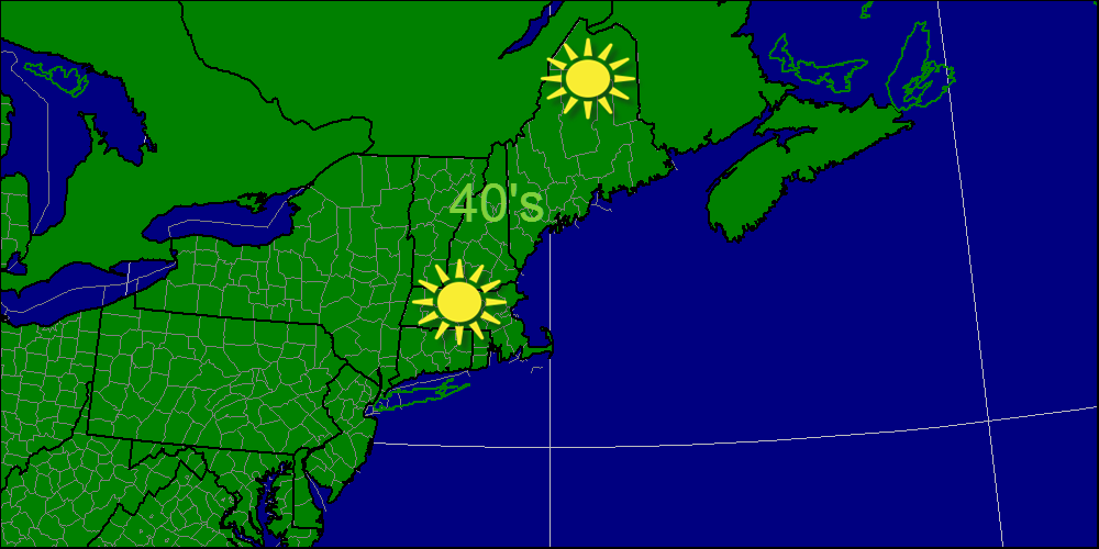
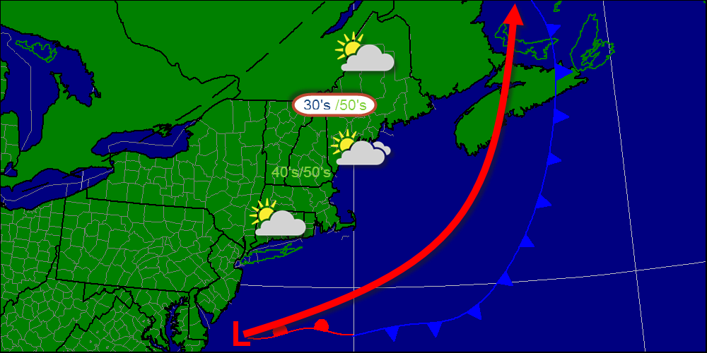
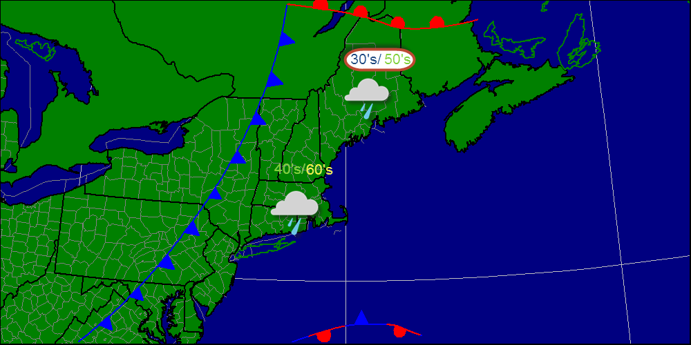
Yesterday, windy conditions prevailed due to the passage of a cold front. Today, winds have relaxed but the cold air is in full control with the high temps struggling to get out of the 40's. Full sun is expected with the exception of a few clouds over far northwestern Maine. Enjoy, rain is slated to arrive for Halloween! -Jack
Today, a cold front will move in from the west and ahead of it, high clouds and breezy conditions will be common. Winds will be out of we SW backing to the W at between 15-20mph. Ahead of the front high cirrus clouds will develop as well. The front will pass through tonight with showers in northern ME and the chance for a sprinkle elsewhere. -Jack
Over the next few days, cool weather will continue over the region as another cold front passes through the region Monday night. Winds will increase Monday out of the SW ahead of the front and pick up out of the NW Tuesday after the front passes. Top winds will likely be Monday reaching 25 mph in exposed spots. Late-week warm weather returns with the threat of rain possibly arriving Friday or Saturday. Uncertainty is very high here however so I did not include rain in my forecast right now. -Jack
Today, the low pressure system that brought us wind yesterday is moving to the NE so winds will relax to about 10 mph from the NW. Sunny and cool conditions prevail today. Rain returns Saturday night but leaves in a hurry so the weekend will not be impacted. Saturday will also feature windy conditions out of the SW. That's it for me until Monday, have a great weekend! -Jack
Today, a low pressure system is rapidly strengthening over the Canadian Maritimes which will result in windy conditions across the region. In addition to that, the highest elevations will see some up-slope snow showers. Little or no accumulations are expected however. -Jack
A coastal low will pass far enough offshore that impacts will be limited to some clouds mainly along the coast. The big difference you will notice today is the temperatures. It will be a lot cooler that usual especially in areas along the coast that haven't seen temps in the low 40's since last spring. Enjoy the cool weather! -Jack
Today a cold front will move across the area bringing showers to the region. This will also be the last day of mild temps before a long cold spell. Enjoy the warmth while it lasts! -Jack
Today marks the last day of sunny AND mild weather across the region for a while. Temps will rise into the 50's in the north and 60's south. Tomorrow a front advances from the west, not quite getting here in time for making tomorrow cool, but clouds and rain will be the big story in 24 hours time. -Jack
After a prolonged "Indian summer" here in New England, A cool down is on the way. A large upper level trough will steer a bit of energy through the Mid Atlantic and off the coast where it will form a low pressure area by Wednesday. Models then diverge on the intensity and placement of the storm. There are 2 main camps- the Euro and the GFS take the storm to the NNE and rapidly deepen it off the New England coast. This would bring a cold rain to the coast and a wintry mix to the mountains. The GEFS and the CMC take the storm to the E and keep it very weak. Because the GFS and the Euro agree, which they never do, I will go with a coastal low moving NE off of Cape Cod, inside the benchmark of 40N 70W though that will make little significance this time as snow is not a factor other than at the highest elevations. Beyond this, as the low moves NE, the return flow on the backside of the low will bring in cold air for Friday into the weekend. With this, frosts and freezes should be expected even at the coast. Also, areas typically favored for up-slope snow showers will likely see their first flakes especially high elevations. Due to the high temperatures of the soil at this time of year, little to no accumulations are expected. This graphic shows how the week will start-mild with temps in the upper 50's and low 60's which might feel a little crisp because we've gotten accustomed to temps in the 60's and 70's. High pressure will be in control during this time so mostly sunny skies will dominate the region. Later in the week, after a cold front tomorrow lowering temps and another one early mid week, the coastal low I discussed above will move offshore as chillier conditions spread over the region. I left a question mark because run-to-run consistency has been very low although agreement is high that the threat is there for a low to form. During this period, coastal regions will likely see their first frost. Next weekend, the low moves into the Maritimes bringing a stiff NW wind that will likely produce some up-slope rain/snow showers. That same NW wind will also usher in more cold air that should stay in place for as long as I can tell.
-Jack Today will look a lot like yesterday with the better half of the day being the second half. Rain will exit Southern Maine this morning, and Northern Maine by late afternoon. Expect mostly sunny skies and warm temps elsewhere with the chance for some fog along the coast. -Jack
|