After a prolonged "Indian summer" here in New England, A cool down is on the way. A large upper level trough will steer a bit of energy through the Mid Atlantic and off the coast where it will form a low pressure area by Wednesday. Models then diverge on the intensity and placement of the storm. There are 2 main camps- the Euro and the GFS take the storm to the NNE and rapidly deepen it off the New England coast. This would bring a cold rain to the coast and a wintry mix to the mountains. The GEFS and the CMC take the storm to the E and keep it very weak. Because the GFS and the Euro agree, which they never do, I will go with a coastal low moving NE off of Cape Cod, inside the benchmark of 40N 70W though that will make little significance this time as snow is not a factor other than at the highest elevations.
Beyond this, as the low moves NE, the return flow on the backside of the low will bring in cold air for Friday into the weekend. With this, frosts and freezes should be expected even at the coast. Also, areas typically favored for up-slope snow showers will likely see their first flakes especially high elevations. Due to the high temperatures of the soil at this time of year, little to no accumulations are expected.
Beyond this, as the low moves NE, the return flow on the backside of the low will bring in cold air for Friday into the weekend. With this, frosts and freezes should be expected even at the coast. Also, areas typically favored for up-slope snow showers will likely see their first flakes especially high elevations. Due to the high temperatures of the soil at this time of year, little to no accumulations are expected.
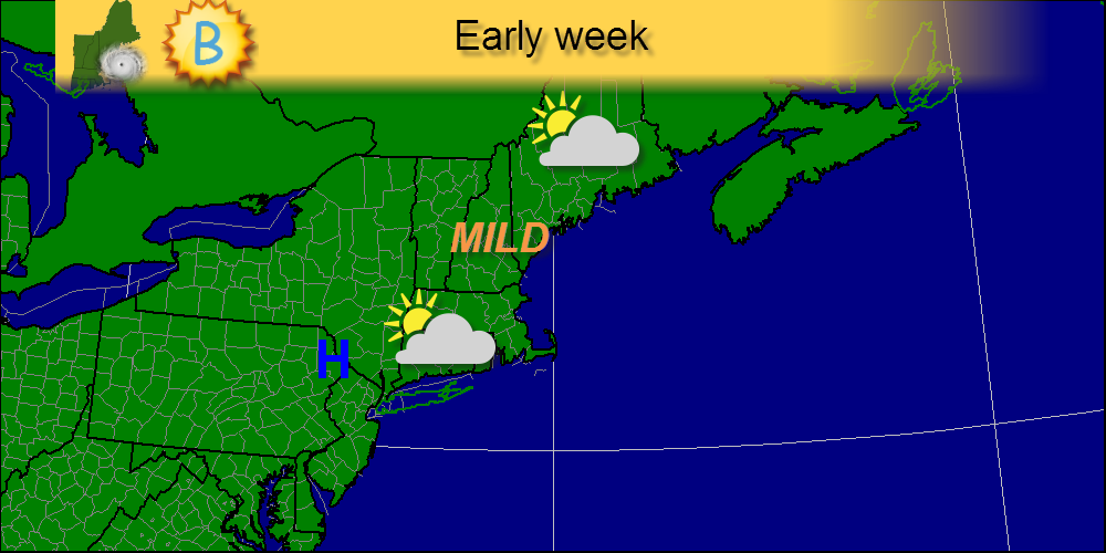
This graphic shows how the week will start-mild with temps in the upper 50's and low 60's which might feel a little crisp because we've gotten accustomed to temps in the 60's and 70's. High pressure will be in control during this time so mostly sunny skies will dominate the region.
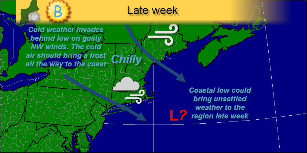
Later in the week, after a cold front tomorrow lowering temps and another one early mid week, the coastal low I discussed above will move offshore as chillier conditions spread over the region. I left a question mark because run-to-run consistency has been very low although agreement is high that the threat is there for a low to form. During this period, coastal regions will likely see their first frost.
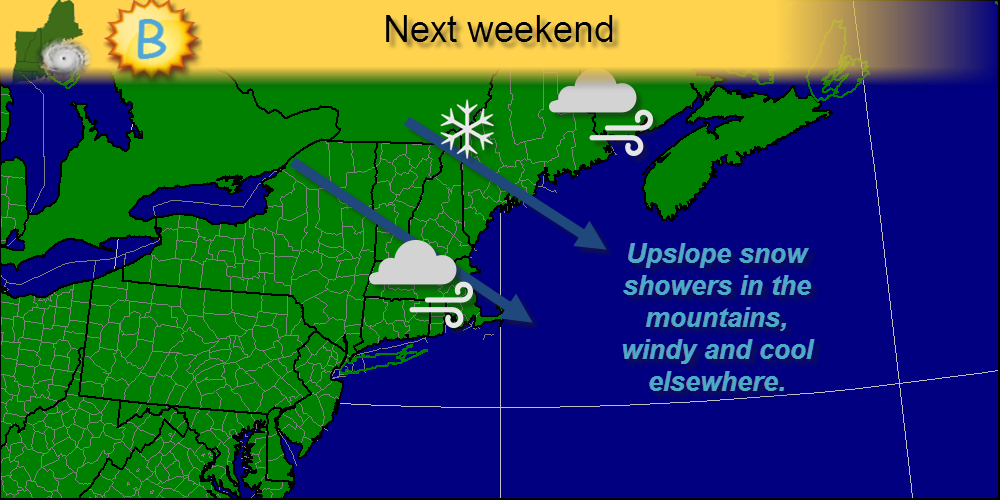
Next weekend, the low moves into the Maritimes bringing a stiff NW wind that will likely produce some up-slope rain/snow showers. That same NW wind will also usher in more cold air that should stay in place for as long as I can tell.
-Jack
-Jack
 RSS Feed