Hello everyone!
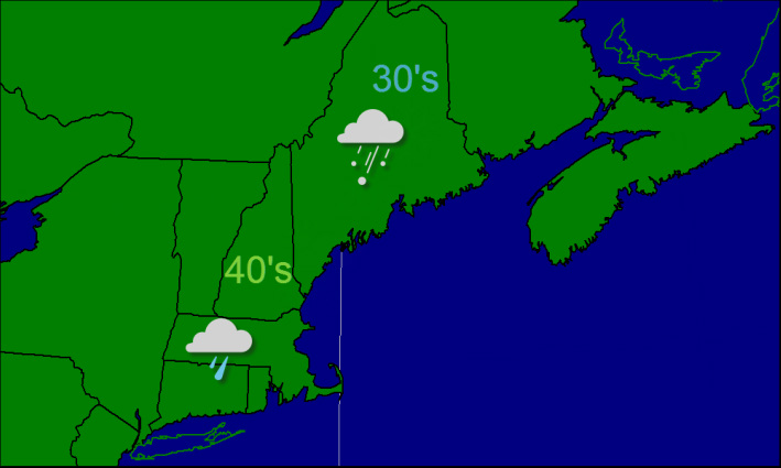
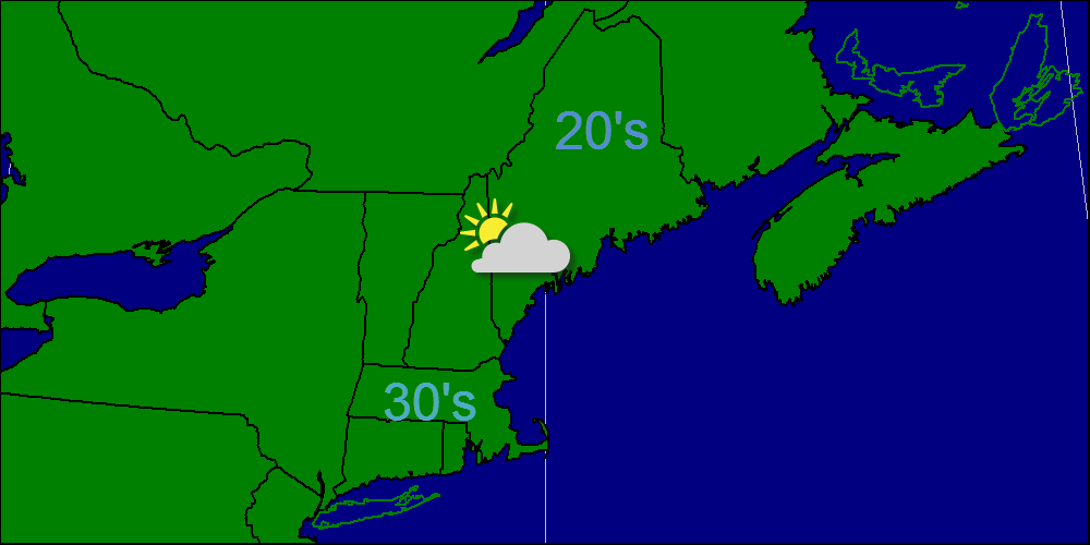
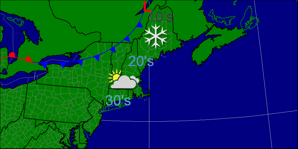
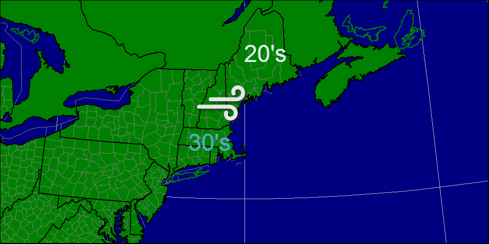
After a light snow event yesterday, we are headed into a warmer pattern for the next few days as winds turn to the southwest. Temps will rise above freezing today into the 30′s and will hit 40 in some spots Saturday and Sunday.
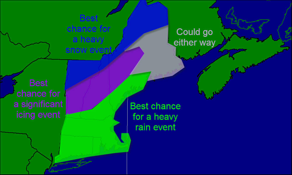
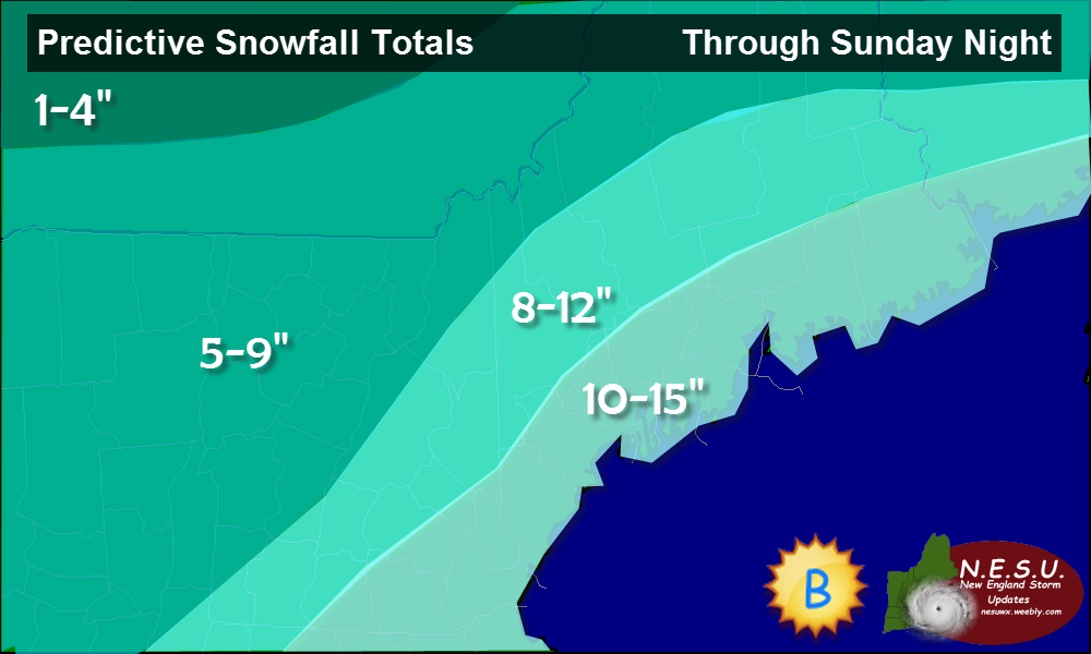
Sunday night is when the forecast gets tricky. A storm system will be moving out of the Great Lakes in one part of the Jet Stream. Another storm system in the southern Jet Stream will be moving out of the Gulf of Mexico. If they can join together, or “phase”, than the storm would be a lot stronger. Right now, I think that they will not phase resulting in a weaker storm system.
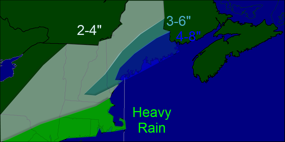
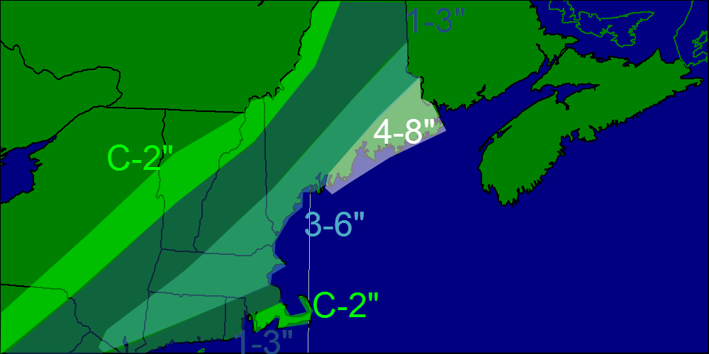
The other question in the forecast is about temperatures. For the 2 days before the storm, winds will be blowing from the southwest ushering in warm air. As a result, precipitation type becomes an issue. As of now, I expect a mostly snow event with the exceptions being in the Midcoast region and coastal York county. Amounts will be held down slightly there though the snow map reflects higher liquid amounts along the Midcoast rather than the mixing potential.
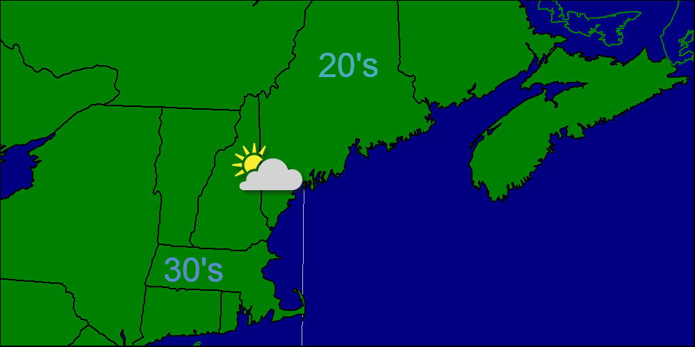
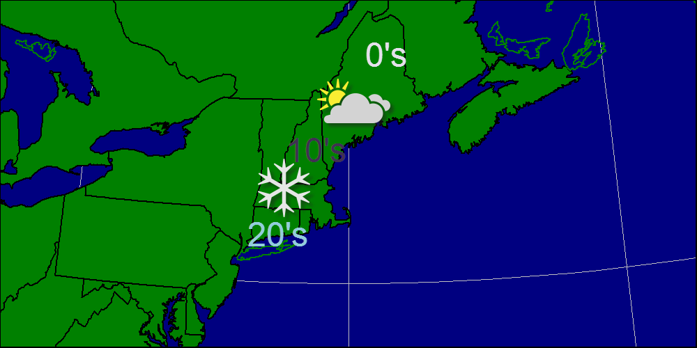
After this system, strong NW winds will bring in very cold air from Canada with highs in the low teens and lows well below 0. There is another storm on the horizon in about a week however, it is too far out to discuss that in any detail.
Snow map is below.
-Jack
After a light snow event yesterday, we are headed into a warmer pattern for the next few days as winds turn to the southwest. Temps will rise above freezing today into the 30′s and will hit 40 in some spots Saturday and Sunday.
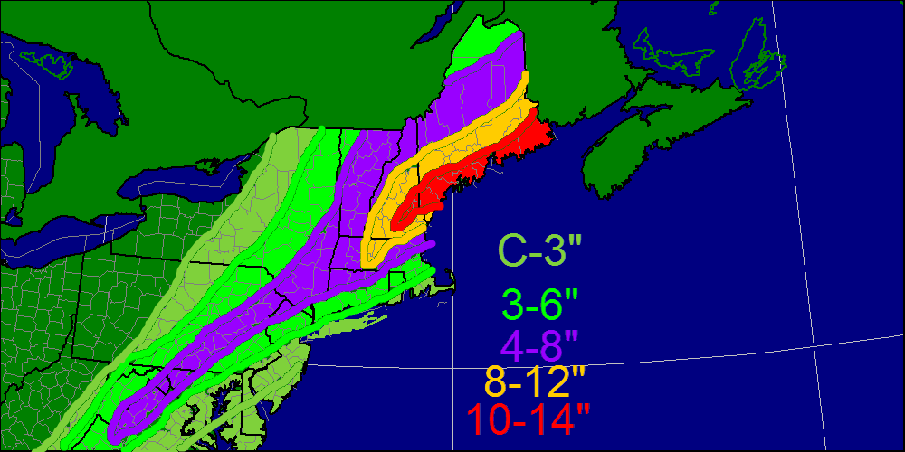
Sunday night is when the forecast gets tricky. A storm system will be moving out of the Great Lakes in one part of the Jet Stream. Another storm system in the southern Jet Stream will be moving out of the Gulf of Mexico. If they can join together, or “phase”, than the storm would be a lot stronger. Right now, I think that they will not phase resulting in a weaker storm system.
The other question in the forecast is about temperatures. For the 2 days before the storm, winds will be blowing from the southwest ushering in warm air. As a result, precipitation type becomes an issue. As of now, I expect a mostly snow event with the exceptions being in the Midcoast region and coastal York county. Amounts will be held down slightly there though the snow map reflects higher liquid amounts along the Midcoast rather than the mixing potential.
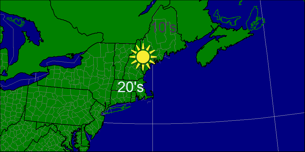
After this system, strong NW winds will bring in very cold air from Canada with highs in the low teens and lows well below 0. There is another storm on the horizon in about a week however, it is too far out to discuss that in any detail.
Snow map is below.
-Jack
 RSS Feed