With the storm only 2 days out now, we have a much clearer picture of what will play out over the Eastern Seaboard on the busiest travel day of the year. It looks like the coast will be all rain while inland areas will start with snow then switch over to rain as the day goes on. Even the highest elevations will see rain at some point Wednesday with temps reaching into the 50's on the coastal plain and 40's inland.
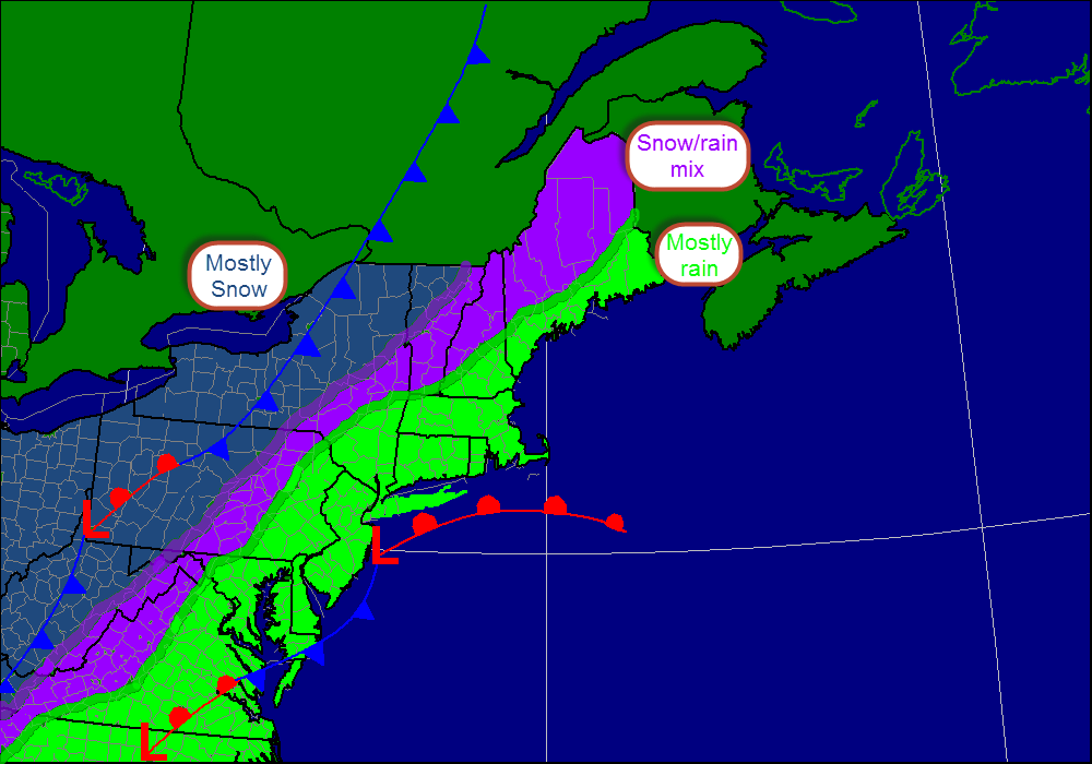
This is my thinking as to the type of precipitation. I expect the only spot in New England to see accumulations will be NW Vermont. The big cities and the I-95 corridor will see a windswept rain shown in green while freezing rain and sleet could cause problems in the purple shaded area. Accumulating snow, shown in blue will be confined to areas like State College PA and Buffalo NY.
Rain
Rain will be the main story with this storm as the westerly track will put most on the warm side of the low. Accumulations of 2-5" will be possible region wide with the bulls eye being over central CT. Minor street flooding could become an issue especially in CT where the heaviest rain will be focused. Rain will begin late Tuesday night over southern areas spreading northward through Tuesday night. Rain will become heavy at times Wednesday as the low intensifies. If you're travelling Wednesday, expect slow going on interstates 95, 93, and 89 due to wet conditions.
Snow
Snow will be confined to far NW VT, upstate NY, PA, OH, and the mountains of the Southern Appalachians. Snow amounts could be quite hefty in areas where lake effect off the northwest winds behind the storm could add to totals. Amounts on the order of 3-6" will be most common though lake effect zones could see upwards of 8".
Wind
Winds will strengthen out of the southwest tomorrow in anticipation of the storm. This will bring in warmer air resulting in the precipitation being mostly rain. On Wednesday, winds will become very strong out of the SW gusting close to 50 or 55 mph by evening. This combined with the saturated ground will likely cause power outage problems. Winds will turn gusty out of the NW on Thanksgiving ushering in bitter temps for those crazy enough to line up outside of stores before black Friday.
I'll have another update tonight if the forecast drastically changes, otherwise I'll be back tomorrow.
-Jack
 RSS Feed