As the storm slated to hit Midweek approaches, models are beginning to agree that a complex storm system will move up the coast bringing heavy precipitation. However, where agreement is lacking is in terms of precipitation type.
Lets start Wednesday morning when heavy precipitation begins to cause travel problems centered around the I-95 corridor. While low pressure is likely still centered in Georgia, a strong front extending well into Maine will cause heavy precipitation up and down the Eastern Seaboard.
Air Travel
As the storm winds up over the East Coast, Air travel will be significantly impacted as high winds and heavy precipitation will affect cities like Washington D.C, New York City, Philadelphia, and Boston. Significant delays are expected starting Tuesday night and likely lasting through Wednesday night. Major airports that will be affected are:
BOS (Boston),
JFK (New York Kennedy),
LGA (New York LaGuardia),
EWR (Newark),
IAD (Washington D.C. Dulles),
DCA (Washington National),
PHL (Philadelphia)
CLT (Charlotte, NC)
SAV (Savannah, GA)
ATL (Atlanta, GA)
Keep in mind that many smaller airports like Portland, ME (PWM), and Hartford, CT (BDL) will also be affected.
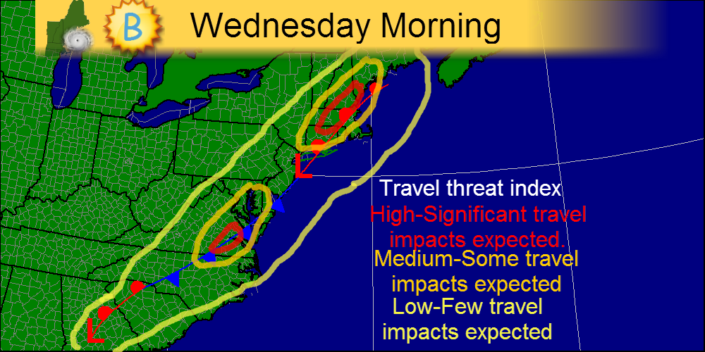
The map above shows where I expect the most significant ravel headaches Wednesday morning. Areas like SE Virginia and Central New England are in the bulls eye for travel delays Wednesday morning.
Land Travel
For those traveling by Train, Bus, or Car, you will likely experience wet and windy conditions on the I-95 corridor starting Tuesday in the South, and Wednesday as you head farther north. Expect slow going around D.C., New York, and Boston especially later in the day as the storm winds up.
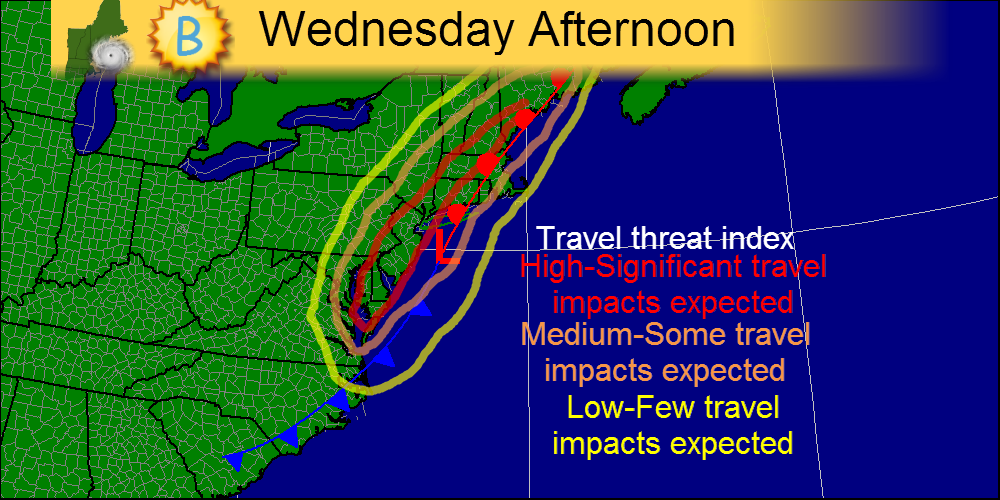
The map above shows where I expect travel to be worst during Wednesday afternoon. Bands of heavy precipitation will be affecting all the major hubs-New York, Boston, and D.C. so significant travel delays are likely.
I will most likely have another quick update tonight.
-Jack
I will most likely have another quick update tonight.
-Jack
 RSS Feed