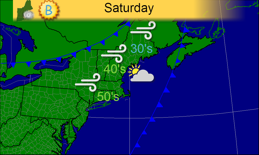
As we head into Thanksgiving week, the weather will continue to be active. We have a strong cold front that will move through tonight with a round of sleet, freezing rain, rain, and, for the highest elevations, snow. For Saturday, reasonably nice conditions will dominate with sunny skies, cool temps and gusty winds.
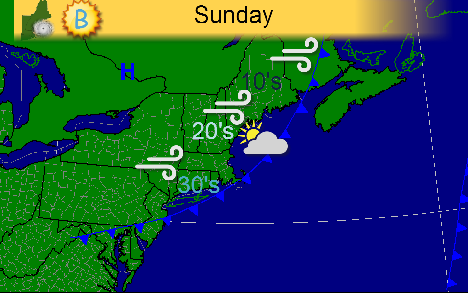
Saturday night will feature the passage of an arctic cold front that will usher in the coldest air of the season along with some very gusty winds. Mostly sunny and breezy conditions can be expected for Sunday.
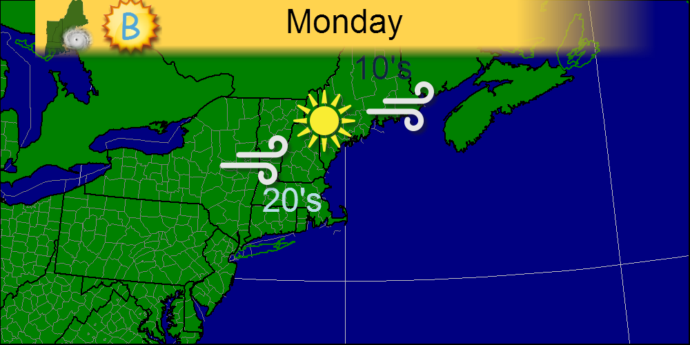
Monday, winds are still active although they will calm down as the evening progresses. Mid-winter like highs will dominate with highs in the 10's and 20's down even to Cape Cod and the CT coast. Full sun will again take full command of the skies.
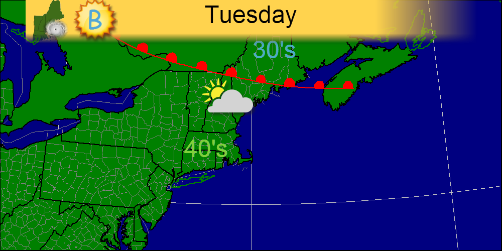
Tuesday will feature the passage of a weak warm front resulting in nothing more than an end to the incessant NW winds and an increase in clouds. This begins our hyperactive weather pattern for the week.
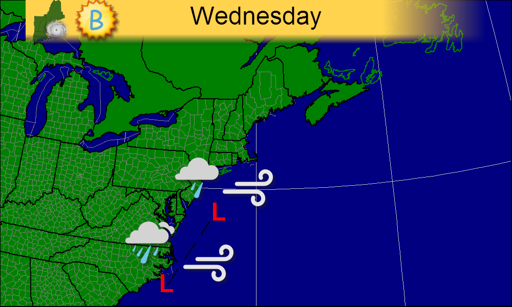
Wednesday is where it starts to get interesting for some. Here in New England, CT and RI will begin to feel the effects of the storm with light rain late in the day. Winds will also begin to increase during this time reaching 15-20mph by sundown.
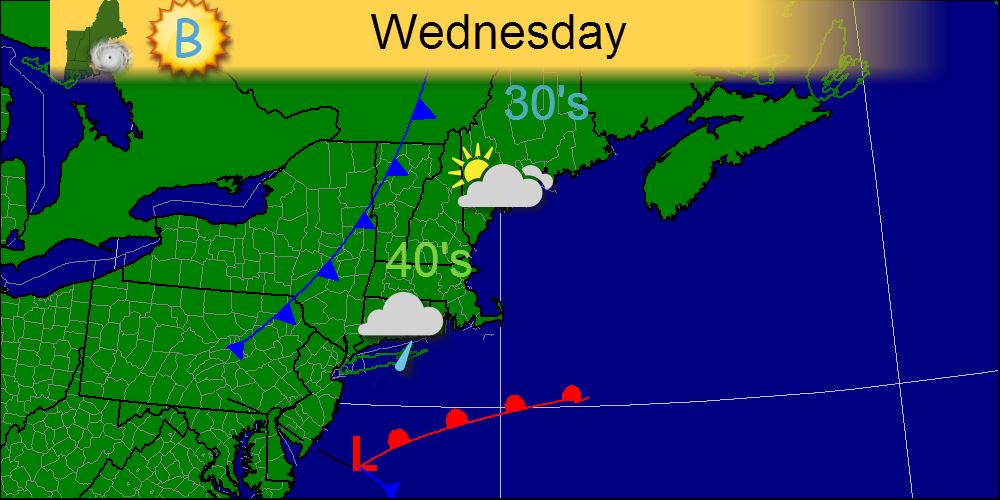
Regarding the larger picture, low pressure begins to organize off the VA coast in 2 separate areas. The models diverge at this point as to the strength and position of both lows however, raw conditions are likely to affect parts of Delaware and southern New Jersey as well as the Outer Banks of North Carolina. Model guidance is rather shaky regarding the development and placement of the lows so uncertainty is high.
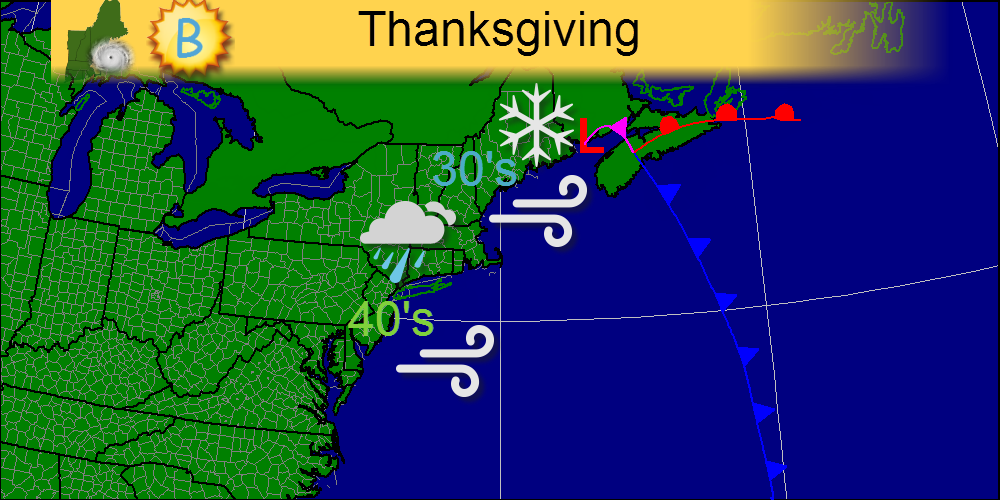
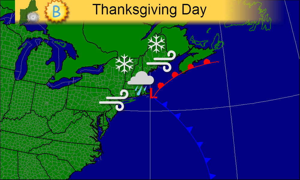
As Thanksgiving Day rolls around, the storm could really get going off the New England coast pushing precipitation ashore. At the moment, it looks like cities like Boston, Providence, and New York will stay all rain however cities like Hartford, Springfield, and even Portland Maine will see frozen precipitation at some point. It's too early to talk amounts, but travel disruptions will be major regardless. I'll include 2 maps below: one for just New England, and one for the entire NE US.
The map above is for the afternoon, while the low is pulling away. Precipitation should stop by 2-3 depending on the eventual timing of the low. As I said before, the forecast is uncertain especially 6 days out so the forecast will most likely change.
This map is for the morning hours-what looks to be the height of the storm at this point. Stay tuned as the forecast will likely evolve over the coming days. Happy Thanksgiving!
-Jack
-Jack
 RSS Feed