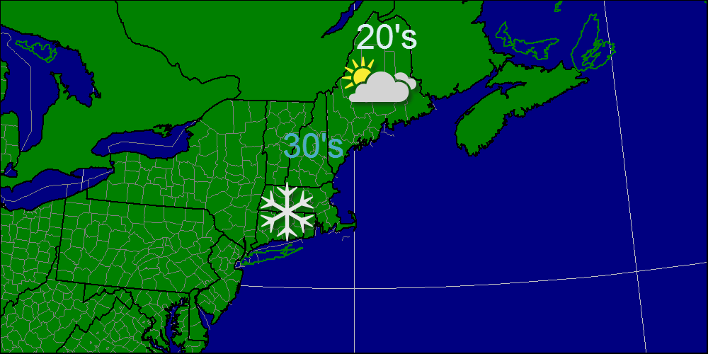
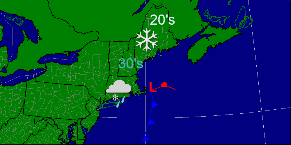
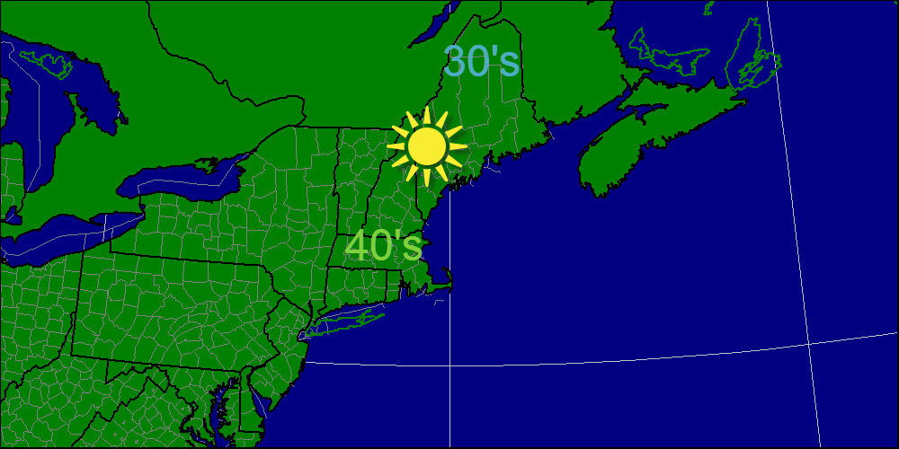
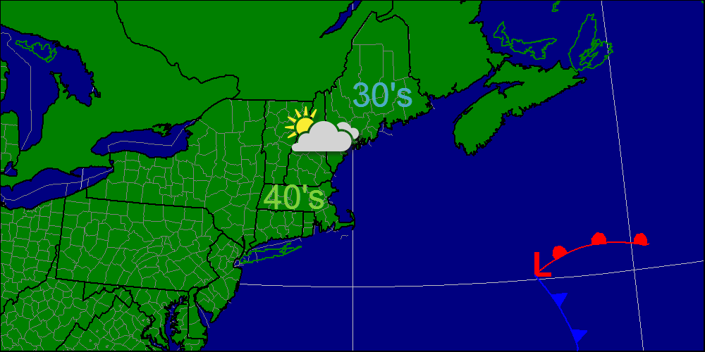
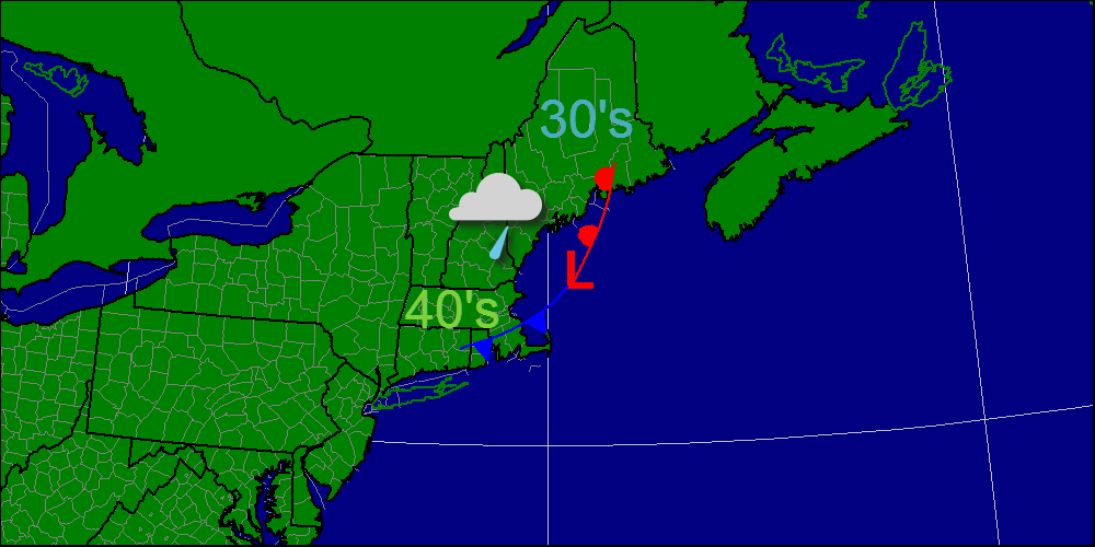
Today, a weak area of low pressure will move out into the ocean bringing a period of snow to southern New England. Here in Northern New England, I expect nothing but clouds and maybe a stray flurry. Snow amounts will be in the 2-4" range for most in southern New England. Temps will be cool, in the 20's and 30's but enjoy the warm weather, today will be our last day above freezing until next week. Winter is here! Below is my video describing the weather for the next few days. -Jack
A weak area of low pressure will slide NE of the coast today bringing a batch of light wintry precipitation to the region. I expect very little in the way of snowfall accumulations mainly in the 1-3" range with the exception of far southern New England where rain will be the dominant precipitation type. After today's wintry precip, arctic air is going to build in leading to clear skies and very chilly temps. -Jack
A weak area of low pressure will bring wintery precipitation to the area tomorrow. Today will feature the passage of s strong cold front that will being precipitation to the region. This precipitation is currently affecting western sections and is moving east. Temperatures today will be quite interesting as they will follow a non diurnal curve- geek speak for when the warmest temperatures occur in the morning, and the coolest in the afternoon. Looking ahead, waves of low pressure could bring snow to the region tonight and Monday. -Jack
Today, a warm front will approach from the south resulting in some light precipitation mainly after 3 or so. The precipitation should be all rain across most areas except far northern areas and the mountains. We will be entering a rather active pattern in the next few days so expect frequent precipitation. Tomorrow will feature rain while Saturday could feature snow. Sunday should be clear before a coastal storm arrives Monday. -Jack
Today, high pressure will be in control of our weather with full sun and temps in the 40's for most towns. Some northern areas will stay in the 30's but overall it should be pretty warm. Enjoy this weather while it lasts because rain is in the forecast tomorrow into Friday. Beyond that, there is the potential for a coastal low to deliver a bit of snowfall to the region Monday. -Jack
Today will feature mostly cloudy skies as an area of low pressure passes well offshore. I do not expect any precipitation from this and its effects will be limited to clouds and a light NW wind. Temps will be cool but not cold in the 30's and 40's. Looking ahead, confidence is increasing that a strong storm and an arctic outbreak could coincide possibly bringing snow. -Jack
This morning will feature wet conditions as a weak storm moves through the Gulf of Maine. The rain is currently focused over the Mid coast as will likely remain locked there before drifting eastward with the low. This afternoon, skies will begin to clear out and most areas will likely see some sun before it sets at 4:04 this afternoon. Have a great start to December! -Jack
Our storm is now well underway and it is behaving exactly as we thought it would. Warm air is flooding into the region on strong SE winds. These winds will continue to intensify with the storm. I recorded .73 inches of precipitation this morning and it it still raining hard. I expect the rain to continue through the day tapering to showers as the evening approaches. Winds should start to let up this afternoon but will re-intensify out of the NW overnight ushering very cold air for the remainder of the week. For those who shop on Black Friday, you will encounter very, very cold temps and bitter winds.
Have a great Thanksgiving everyone! -Jack Our storm we have been looking at for a week or so is now kicking into gear over the southeastern US. Rain is spreading northward covering most of the Mid Atlantic states and moving into NYC right now. This morning's precipitation was unrelated associated with a weak warm front that dropped about an inch or so of snow. That is now long gone and temps today will rise to near 40 at the coast and 30 inland.
Precipitation should arrive just after sundown tonight becoming heavy at times. Winds and rain will both pick up in intensity by morning with the worst conditions arriving mid-morning. Rain and wind will continue through the afternoon with the rain diminishing in intensity while the wind holds steady at about 40-50 mph. Wind and rain will diminish in intensity and coverage Wednesday night as the front passes through. We may see a quick shot of snow early Thursday morning but accumulations should be limited to a dusting at best. Winds will become strong out of the NW much like those we saw on Sunday for Thanksgiving day. The mountains should see some up-slope snow showers accumulating 2-4" in favored zones. I expect near 3-3.5" of rain over the area which will cause a rapid rise in streams and rivers despite a relatively dry October-November. Minor flooding could become an issue with very heavy rain rates Wednesday morning. Winds will gust near 50 mph over coastal areas with 40 mph winds inland. With the ground saturated from the heavy rains, power outages will become an issue. Winds will increase out of the SE tonight ahead of the storm and steadily strengthen. Winds will peak between 9 am and 1 pm and subside after that. Winds will again become gusty on Thanksgiving but out of the NW ushering in cooler air. If anything drastically changes, I will have another update tonight but otherwise, I'll have another update on Wednesday morning. -Jack |